Geolocate
👉 Easily get elevation data in JSON, GeoTIFF and KML formats using Elevation API
Thank you for supporting this site ❤️
Make a donation

Roomo topographic map

Click on the map to display elevation.

👉 Easily get elevation data in JSON, GeoTIFF and KML formats using Elevation API
Thank you for supporting this site ❤️
Make a donation

About this map

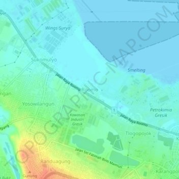
Name: Roomo topographic map, elevation, terrain.

Location: Roomo, Gresik, East Java, Java, 61121, Indonesia (-7.16111 112.60658 -7.12111 112.64658)

Average elevation: 10 m

Minimum elevation: 0 m

Maximum elevation: 45 m

Other topographic maps

Click on a map to view its topography, its elevation and its terrain.

Situs Giri Kedaton

Indonesia > East Java > Gresik > Gresik

Average elevation: 40 m

Sungai Desa Sumput

Indonesia > East Java > Gresik > Driyorejo

Average elevation: 17 m

Telaga Kajen

Indonesia > East Java > Gresik > Kebomas

Average elevation: 41 m