
Thank you for supporting this site ❤️
Make a donation
Make a donation
Lugus Island topographic map
Click on the map to display elevation.
Thank you for supporting this site ❤️
Make a donation
Make a donation
About this map
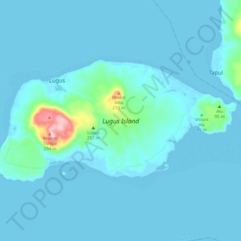
Name: Lugus Island topographic map, elevation, terrain.
Location: Lugus Island, Lugus, Sulu, Bangsamoro, Philippines (5.66200 120.79480 5.71011 120.89021)
Average elevation: 20 m
Minimum elevation: -3 m
Maximum elevation: 268 m
Thank you for supporting this site ❤️
Make a donation
Make a donation
Other topographic maps
Click on a map to view its topography, its elevation and its terrain.
Thank you for supporting this site ❤️
Make a donation
Make a donation
Thank you for supporting this site ❤️
Make a donation
Make a donation
Thank you for supporting this site ❤️
Make a donation
Make a donation
Thank you for supporting this site ❤️
Make a donation
Make a donation