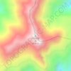
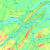
Dayi County topographic map
Click on the map to display elevation.
About this map

Name: Dayi County topographic map, elevation, terrain.
Location: Dayi County, Chengdu, Sichuan, China (30.49637 103.60373 30.50115 103.60977)
Average elevation: 498 m
Minimum elevation: 490 m
Maximum elevation: 504 m
Other topographic maps
Click on a map to view its topography, its elevation and its terrain.



Litang County
Litang County (Tibetan: ལི་ཐང་རྫོང་།; Chinese: 理塘县) is southwest of Garzê Tibetan Autonomous Prefecture, in Sichuan, China, in the traditional Tibetan region of Kham. It contains 7 towns and a population of more than 60,000 in 2020. Due to its elevation and mountainous terrain,…
Average elevation: 4,217 m


Tagong
A gompa is where the Tagong Monastery is located. The gompa is one of the most important in the in Tibetan Pel Lhagong. The Tagong Monastery was established with reference to a nearby sacred mountain, Mt. Yala or Zhara Lhaste, which is 5,820 metres (19,090 ft) in elevation.
Average elevation: 3,874 m


Kangding
Kangding has a monsoon-influenced climate, lying in the transition between a humid continental (Dwb) and a subtropical highland climate (Cwb) on the Köppen system. Despite the elevation of 2,560 metres (8,400 ft), the diurnal temperature variation averages at most 10.6 °C (19.1 °F) in any month. From April…
Average elevation: 3,331 m


Luding County
The county is located within the Hengduan Mountains, within the southeastern edge of the Tibetan Plateau. The town of Luqiao, the county seat, sits at an elevation of 1,321 metres (4,334 ft) above sea level. The highest point in the county is Mount Gongga, along the southwestern border with Kangding. Mount…
Average elevation: 3,158 m

Xichang City
Owing to its low latitude and high elevation, Xichang has a monsoon-influenced humid subtropical climate (Köppen Cwa) milder and far sunnier than the Sichuan Basin, with mild, very sunny and dry winters, and very warm, rainy summers. The monthly 24-hour average temperature ranges from 9.9 °C (49.8 °F) in…
Average elevation: 2,319 m


Jiuzhaigou
China > Sichuan > Jiuzhaigou County
The county consists of nine villages in a valley in Sichuan Province. The main ethnic group in the county is Han, with the second being Tibetan. The county seat has an altitude of about 1,400 m (4,600 ft).[1] It has a total area of 2,041 square miles (5,286 km2).[2] As of 2015, the county's total population…
Average elevation: 2,520 m

Songpan County
Due to its altitude, Songpan has a humid continental climate (Köppen Dwb), with cool winters and warm, rainy summers. The monthly 24-hour average temperature ranges from −3.4 °C (25.9 °F) in January to 14.8 °C (58.6 °F) in July, and the annual mean is 6.28 °C (43.3 °F). The high elevation also results…
Average elevation: 3,301 m

Pidu District
It is now seeking to attract electronics and IT corporations and, in 2015, applied for elevation to urban district status.
Average elevation: 562 m

Jiuzhai Valley National Park
China > Sichuan > Jiuzhaigou County
The Jiuzhaigou valley is part of the Min Mountains on the edge of the Tibetan Plateau and stretches over 72,000 hectares (180,000 acres). It is known for its many multi-level waterfalls, colorful lakes, and snow-capped peaks. Its elevation ranges from 2,000 to 4,500 metres (6,600 to 14,800 ft).
Average elevation: 3,424 m

Qingcheng Mountain
"Located at the peak of Mount Qingcheng with an altitude over 1,500 m, Shangqing Palace marks the end of the touring route of Mount Qingcheng. Buildings such as Laojun Hall, Sanqing Hall, Wenwu Hall, and Tao Te Ching Preaching Hall in the Taoist temple of Shangqing Palace with several cultural relics, were…
Average elevation: 972 m

Garzê Tibetan Autonomous Prefecture
China > Sichuan > Garzê Tibetan Autonomous Prefecture
Average elevation: 3,899 m


Wolong National Nature Reserve
China > Sichuan > Wenchuan County
The giant panda is the most famous species of the reserve. Other typical larger Carnivora are the Ussuri dhole, Asian black bear, Asiatic golden cat, clouded leopard, red panda, hog badger and yellow-throated marten. Hooved mammals are represented by Sichuan takins, wild boar, musk deer, mainland serows,…
Average elevation: 3,044 m

Mount Gongga
Mount Gongga (simplified Chinese: 贡嘎山; traditional Chinese: 貢嘎山; pinyin: Gònggá Shān), also known as Minya Konka (Khams Tibetan: མི་ཉག་གངས་དཀར་རི་བོ་, Khams Tibetan pinyin: Mi'nyâg Gong'ga Riwo) and colloquially as "The King of Sichuan Mountains", is the…
Average elevation: 6,496 m



Lugu Lake
China > Sichuan > Yanyuan County > Mukua
Lugu Lake (simplified Chinese: 泸沽湖; traditional Chinese: 瀘沽湖; pinyin: Lúgū Hú) is located in the northwest of the Yunnan plateau, with the middle of the lake forming the border between the Ninglang County of Yunnan Province and the Yanyuan County of Sichuan Province. The formation of the lake is…
Average elevation: 2,750 m
Mount Emei
China > Sichuan > Emeishan City > Emeishan
The flora of Mount Emei varies with elevation, from subtropical evergreen forests at lower elevations to subalpine shrubland around the summit. The mountain is notable for both its species richness and abundance of endemic plants.
Average elevation: 2,434 m



Sêrxü County
Sêrxü (sershul) County is situated at the northwest corner of Sichuan province, and is also the westernmost county-level division of the province. Its area is approximately 25,000 km2, mainly covered by grasslands. The average elevation is 4,200 m above sea level.
Average elevation: 4,491 m
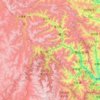
Jiuzhaigou County
The county consists of nine villages in a valley in Sichuan Province. The main ethnic group in the county is Han, with the second being Tibetan. The county seat has an altitude of about 1,400 m (4,600 ft). It has a total area of 2,041 square miles (5,286 km2). As of 2015, the county's total population was…
Average elevation: 3,201 m


Wuhou District
The terrain of Wuhou District is flat, sloping from northwest to southeast, with an average altitude of 502.5 meters. The plains within the territory are composed of flood plains, alluvial fans, fan plains and other plains. The geological structure of the entire region is mainly Quaternary loose accumulations.
Average elevation: 492 m


Kangding
Kangding has a monsoon-influenced climate, lying in the transition between a humid continental (Dwb) and a subtropical highland climate (Cwb) on the Köppen system. Despite the elevation of 2,560 metres (8,400 ft), the diurnal temperature variation averages at most 10.6 °C (19.1 °F) in any month. From April…
Average elevation: 3,331 m

Garze
China > Sichuan > Garzê County
Due to its elevation, Garzê County has a monsoon-influenced humid continental climate (Köppen Dwb) and subarctic climate, with cold but very dry winters, and warm summers with frequent rain. The monthly 24-hour average temperature ranges from −3.9 °C (25.0 °F) in January to 14.2 °C (57.6 °F) in July,…
Average elevation: 4,172 m


Batang County
It is warmer here than most of Tibet (because of the lower altitude) and is reported to be a friendly, easy-going place, surrounded by barley fields. The plain surrounding the town is unusually fertile and produces two harvests a year. The main products include: rice, maize, barley, wheat, peas, cabbages,…
Average elevation: 4,256 m

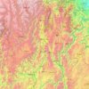
Liangshan
Owing to its low latitude and high elevation, Liangshan has a mild climate. Under the Köppen system, the prefecture belongs to the humid subtropical zone (Köppen Cwa). Winters feature mild days and cool nights, while summers are very warm and humid. Monthly daily mean temperatures range from 9.6 °C (49.3…
Average elevation: 2,434 m
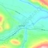
Jiuzhaigou County
The county consists of nine villages in a valley in Sichuan Province. The main ethnic group in the county is Han, with the second being Tibetan. The county seat has an altitude of about 1,400 m (4,600 ft). It has a total area of 2,041 square miles (5,286 km2). As of 2015, the county's total population was…
Average elevation: 3,201 m


Litang County
Litang County (Tibetan: ལི་ཐང་རྫོང་།; Chinese: 理塘县) is southwest of Garzê Tibetan Autonomous Prefecture, in Sichuan, China, in the traditional Tibetan region of Kham. It contains 7 towns and a population of more than 60,000 in 2020. Due to its elevation and mountainous terrain,…
Average elevation: 4,217 m
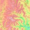
Huanglong Scenic and Historic Interest Area
China > Sichuan > Songpan County
Repeated glaciation events, the unique terrane structure, the formation of tufa, the stratum of carbonic acid rock, and climatic conditions such as Arctic-alpine sunlight have created this world-famous travertine landscape. Huanglong covers an area of 700 km2 at an altitude between 1700m and 5588m. Major…
Average elevation: 3,350 m


Daocheng County
Daocheng County or Dapba in Tibetan (Tibetan: འདབ་པ་རྫོང་།; Chinese: 稻城县) is a county of western Sichuan Province, China, located in the eastern Hengduan Mountains. It is under the administration of the Garzê Tibetan Autonomous Prefecture with an overwhelmingly Tibetan…
Average elevation: 3,926 m