
Mountrail County topographic map
Interactive map
Click on the map to display elevation.
About this map
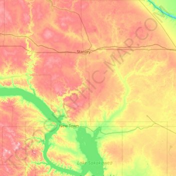
Name: Mountrail County topographic map, elevation, terrain.
Location: Mountrail County, North Dakota, USA (47.75250 -102.88712 48.54830 -101.87113)
Average elevation: 659 m
Minimum elevation: 525 m
Maximum elevation: 838 m
Other topographic maps
Click on a map to view its topography, its elevation and its terrain.
Boundary Lake
Boundary Lake, 23rd Avenue Northeast, Bottineau County, North Dakota, USA
Average elevation: 685 m