
Thank you for supporting this site ❤️
Make a donation
Make a donation
Kungsbacka kommun topographic map
Click on the map to display elevation.
Thank you for supporting this site ❤️
Make a donation
Make a donation
About this map
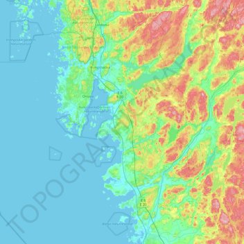
Name: Kungsbacka kommun topographic map, elevation, terrain.
Location: Kungsbacka kommun, Halland County, Sweden (57.14360 11.45355 57.59750 12.41935)
Average elevation: 41 m
Minimum elevation: -1 m
Maximum elevation: 194 m
Thank you for supporting this site ❤️
Make a donation
Make a donation
Other topographic maps
Click on a map to view its topography, its elevation and its terrain.