
Thank you for supporting this site ❤️
Make a donation
Make a donation
High Pine topographic map
Click on the map to display elevation.
Thank you for supporting this site ❤️
Make a donation
Make a donation
About this map
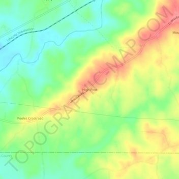
Name: High Pine topographic map, elevation, terrain.
Location: High Pine, Randolph County, Alabama, United States (33.10290 -85.46301 33.14290 -85.42301)
Average elevation: 235 m
Minimum elevation: 196 m
Maximum elevation: 285 m
Thank you for supporting this site ❤️
Make a donation
Make a donation
Other topographic maps
Click on a map to view its topography, its elevation and its terrain.