
Thank you for supporting this site ❤️
Make a donation
Make a donation
Wezeren topographic map
Click on the map to display elevation.
Thank you for supporting this site ❤️
Make a donation
Make a donation
Wezeren
Wezeren ligt in Droog-Haspengouw op een hoogte van 92 meter (kerk) tot 116 meter. De Zevenbronnenbeek loopt langs Wezeren.
Thank you for supporting this site ❤️
Make a donation
Make a donation
About this map
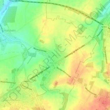
Name: Wezeren topographic map, elevation, terrain.
Location: Wezeren, Landen, Leuven, Vlaams-Brabant, Vlaanderen, België (50.72247 5.09421 50.74176 5.12144)
Average elevation: 98 m
Minimum elevation: 72 m
Maximum elevation: 119 m
Thank you for supporting this site ❤️
Make a donation
Make a donation
Other topographic maps
Click on a map to view its topography, its elevation and its terrain.