
Thank you for supporting this site ❤️
Make a donation
Make a donation
Red Level topographic map
Click on the map to display elevation.
Thank you for supporting this site ❤️
Make a donation
Make a donation
About this map
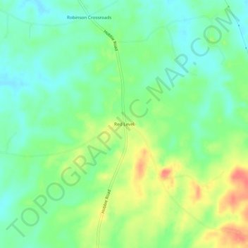
Name: Red Level topographic map, elevation, terrain.
Location: Red Level, Montgomery County, Alabama, United States (32.11431 -86.24330 32.15431 -86.20330)
Average elevation: 96 m
Minimum elevation: 75 m
Maximum elevation: 130 m
Thank you for supporting this site ❤️
Make a donation
Make a donation
Other topographic maps
Click on a map to view its topography, its elevation and its terrain.