Geolocate
👉 Easily get elevation data in JSON, GeoTIFF and KML formats using Elevation API
Thank you for supporting this site ❤️
Make a donation

Malu topographic map

Click on the map to display elevation.

👉 Easily get elevation data in JSON, GeoTIFF and KML formats using Elevation API
Thank you for supporting this site ❤️
Make a donation

About this map

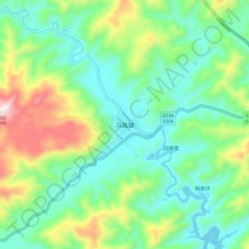
Name: Malu topographic map, elevation, terrain.

Location: Malu, Anhua County, Hunan, China (28.32932 110.98761 28.40932 111.06761)

Average elevation: 376 m

Minimum elevation: 147 m

Maximum elevation: 928 m