
Thank you for supporting this site ❤️
Make a donation
Make a donation
Amherst topographic map
Click on the map to display elevation.
Thank you for supporting this site ❤️
Make a donation
Make a donation
About this map
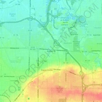
Name: Amherst topographic map, elevation, terrain.
Location: Amherst, Erie, New York, 14226, United States (42.93839 -78.83976 43.01839 -78.75976)
Average elevation: 190 m
Minimum elevation: 172 m
Maximum elevation: 222 m
Thank you for supporting this site ❤️
Make a donation
Make a donation