
Thank you for supporting this site ❤️
Make a donation
Make a donation
Tracy topographic map
Click on the map to display elevation.
Thank you for supporting this site ❤️
Make a donation
Make a donation
About this map
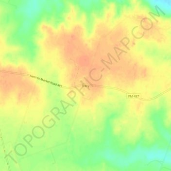
Name: Tracy topographic map, elevation, terrain.
Location: Tracy, Milam County, Texas, United States (30.72186 -97.11721 30.76186 -97.07721)
Average elevation: 130 m
Minimum elevation: 105 m
Maximum elevation: 144 m
Thank you for supporting this site ❤️
Make a donation
Make a donation
Other topographic maps
Click on a map to view its topography, its elevation and its terrain.