
Thank you for supporting this site ❤️
Make a donation
Make a donation
Mawuko topographic map
Click on the map to display elevation.
Thank you for supporting this site ❤️
Make a donation
Make a donation
About this map
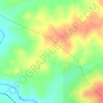
Name: Mawuko topographic map, elevation, terrain.
Location: Mawuko, Abeokuta North, Ogun State, Nigeria (7.21333 3.31333 7.25333 3.35333)
Average elevation: 66 m
Minimum elevation: 31 m
Maximum elevation: 108 m
Thank you for supporting this site ❤️
Make a donation
Make a donation