
Jawai topographic map
Click on the map to display elevation.
About this map
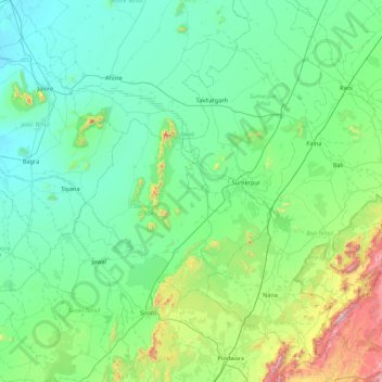
Name: Jawai topographic map, elevation, terrain.
Location: Jawai, Sumerpur Tehsil, Pali, Rajasthan, 343022, India (24.85985 72.36140 25.41013 73.22782)
Average elevation: 302 m
Minimum elevation: 142 m
Maximum elevation: 1,127 m
Other topographic maps
Click on a map to view its topography, its elevation and its terrain.