
Thank you for supporting this site ❤️
Make a donation
Make a donation
Hafia topographic map
Click on the map to display elevation.
Thank you for supporting this site ❤️
Make a donation
Make a donation
About this map
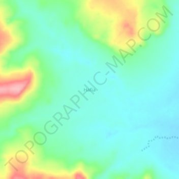
Name: Hafia topographic map, elevation, terrain.
Location: Hafia, Faranah Region, Guinea (11.71573 -10.47640 11.75573 -10.43640)
Average elevation: 461 m
Minimum elevation: 422 m
Maximum elevation: 556 m
Thank you for supporting this site ❤️
Make a donation
Make a donation
Other topographic maps
Click on a map to view its topography, its elevation and its terrain.