
Thank you for supporting this site ❤️
Make a donation
Make a donation
Otta topographic map
Click on the map to display elevation.
Thank you for supporting this site ❤️
Make a donation
Make a donation
About this map
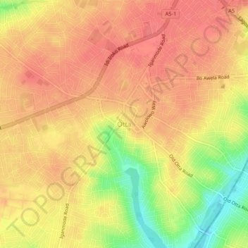
Name: Otta topographic map, elevation, terrain.
Location: Otta, Ado Odo/Ota, Ogun State, Nigeria (6.66414 3.21275 6.70414 3.25275)
Average elevation: 55 m
Minimum elevation: 12 m
Maximum elevation: 74 m
Thank you for supporting this site ❤️
Make a donation
Make a donation