
City of Belgrade topographic map
Interactive map
Click on the map to display elevation.
About this map
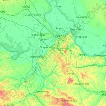
Name: City of Belgrade topographic map, elevation, terrain.
Location: City of Belgrade, Central Serbia, Serbia (44.26283 19.97566 45.09706 20.85339)
Average elevation: 136 m
Minimum elevation: 37 m
Maximum elevation: 682 m
Other topographic maps
Click on a map to view its topography, its elevation and its terrain.
Trstenik
Serbia > Central Serbia > Rasina Administrative District > Trstenik Municipality > Trstenik
Average elevation: 263 m