
Montalegre topographic map
Interactive map
Click on the map to display elevation.
About this map
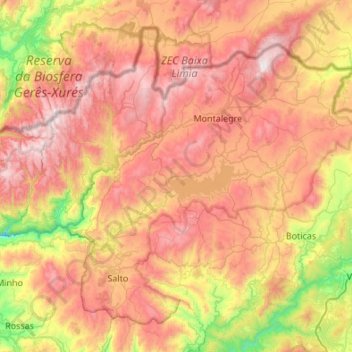
Name: Montalegre topographic map, elevation, terrain.
Location: Montalegre, Vila Real, Portugal (41.58690 -8.11947 41.92710 -7.57953)
Average elevation: 834 m
Minimum elevation: 247 m
Maximum elevation: 1,523 m
Other topographic maps
Click on a map to view its topography, its elevation and its terrain.