
Thank you for supporting this site ❤️
Make a donation
Make a donation
Cinder Cone topographic map
Click on the map to display elevation.
Thank you for supporting this site ❤️
Make a donation
Make a donation
About this map
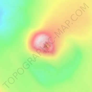
Name: Cinder Cone topographic map, elevation, terrain.
Location: Cinder Cone, Lake and Peninsula, Alaska, United States (56.19573 -159.39031 56.19583 -159.39021)
Average elevation: 1,843 m
Minimum elevation: 1,607 m
Maximum elevation: 2,128 m
Thank you for supporting this site ❤️
Make a donation
Make a donation
Other topographic maps
Click on a map to view its topography, its elevation and its terrain.
Thank you for supporting this site ❤️
Make a donation
Make a donation
Thank you for supporting this site ❤️
Make a donation
Make a donation
Aniakchak National Monument
United States > Alaska > Lake and Peninsula
The national monument is centered on the 6-mile (9.7 km) diameter crater of ancient Mount Aniakchak, which was destroyed and the resulting crater formed during a caldera collapse event about 3,700 years ago. The original mountain, about 7,000 feet (2,100 m) tall, collapsed into its magma chamber, leaving an…
Average elevation: 376 m