
Thank you for supporting this site ❤️
Make a donation
Make a donation
The Pointe topographic map
Click on the map to display elevation.
Thank you for supporting this site ❤️
Make a donation
Make a donation
About this map
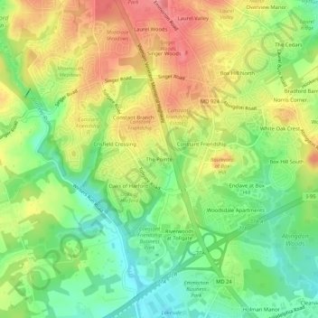
Name: The Pointe topographic map, elevation, terrain.
Location: The Pointe, Harford County, Maryland, 21009, United States (39.44844 -76.33774 39.48844 -76.29774)
Average elevation: 48 m
Minimum elevation: 6 m
Maximum elevation: 93 m
Thank you for supporting this site ❤️
Make a donation
Make a donation
Other topographic maps
Click on a map to view its topography, its elevation and its terrain.
Aberdeen Proving Ground
United States > Maryland > Harford County > Aberdeen Proving Ground
Average elevation: 7 m
Darlington
United States > Maryland > Harford County > Darlington > Hopkins Corner
Average elevation: 88 m
Thank you for supporting this site ❤️
Make a donation
Make a donation
Thank you for supporting this site ❤️
Make a donation
Make a donation