
Thank you for supporting this site ❤️
Make a donation
Make a donation
Bagacay topographic map
Click on the map to display elevation.
Thank you for supporting this site ❤️
Make a donation
Make a donation
About this map
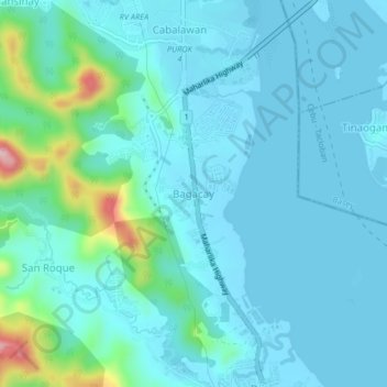
Name: Bagacay topographic map, elevation, terrain.
Location: Bagacay, Tacloban, Eastern Visayas, Philippines (11.26246 124.93900 11.30246 124.97900)
Average elevation: 33 m
Minimum elevation: -1 m
Maximum elevation: 225 m
Thank you for supporting this site ❤️
Make a donation
Make a donation
Other topographic maps
Click on a map to view its topography, its elevation and its terrain.