
Thank you for supporting this site ❤️
Make a donation
Make a donation
Detroit Lake topographic map
Click on the map to display elevation.
Thank you for supporting this site ❤️
Make a donation
Make a donation
Detroit Lake
The water level fluctuates with snow pack, precipitation, and the water consumption of Salem, and surrounding areas. At low pool, it has a surface elevation of 1,450 feet (440 m); at the full pool season—typically May 1 to September 1—it can raise up 119 feet (36 m) to a water elevation of 1,569 feet (478 m).
Thank you for supporting this site ❤️
Make a donation
Make a donation
About this map
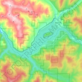
Name: Detroit Lake topographic map, elevation, terrain.
Average elevation: 799 m
Minimum elevation: 371 m
Maximum elevation: 1,487 m
Thank you for supporting this site ❤️
Make a donation
Make a donation