
Thank you for supporting this site ❤️
Make a donation
Make a donation
Le Tertre Juin topographic map
Click on the map to display elevation.
Thank you for supporting this site ❤️
Make a donation
Make a donation
About this map
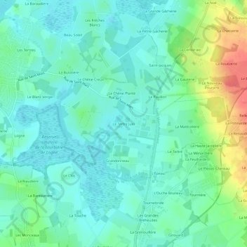
Name: Le Tertre Juin topographic map, elevation, terrain.
Average elevation: 17 m
Minimum elevation: 1 m
Maximum elevation: 62 m
Thank you for supporting this site ❤️
Make a donation
Make a donation
Other topographic maps
Click on a map to view its topography, its elevation and its terrain.
Île Saint-Denis
France > Pays de la Loire > Loire-Atlantique > Sucé-sur-Erdre > Île Saint-Denis
Average elevation: 6 m