
Alexandria topographic map
Interactive map
Click on the map to display elevation.
About this map
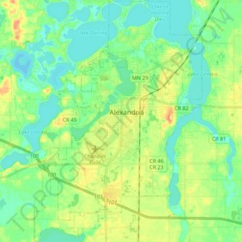
Name: Alexandria topographic map, elevation, terrain.
Location: Alexandria, Douglas County, Minnesota, 56308, USA (45.82502 -95.43445 45.93395 -95.32556)
Average elevation: 426 m
Minimum elevation: 412 m
Maximum elevation: 450 m