
陈塸镇 topographic map
Interactive map
Click on the map to display elevation.
About this map
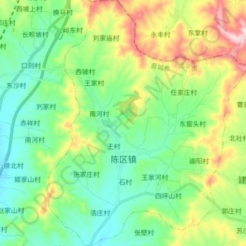
Name: 陈塸镇 topographic map, elevation, terrain.
Location: 陈塸镇, 高平市, 晋城市, 山西省, 中国 (35.81221 112.99556 35.91486 113.10048)
Average elevation: 1,020 m
Minimum elevation: 874 m
Maximum elevation: 1,352 m