
Thank you for supporting this site ❤️
Make a donation
Make a donation
Center Point topographic map
Click on the map to display elevation.
Thank you for supporting this site ❤️
Make a donation
Make a donation
About this map
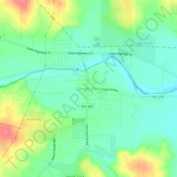
Name: Center Point topographic map, elevation, terrain.
Location: Center Point, Kerr County, Texas, United States (29.92226 -99.05688 29.96226 -99.01688)
Average elevation: 471 m
Minimum elevation: 446 m
Maximum elevation: 519 m
Thank you for supporting this site ❤️
Make a donation
Make a donation
Other topographic maps
Click on a map to view its topography, its elevation and its terrain.