
Thank you for supporting this site ❤️
Make a donation
Make a donation
Versailles topographic map
Click on the map to display elevation.
Thank you for supporting this site ❤️
Make a donation
Make a donation
About this map
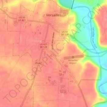
Name: Versailles topographic map, elevation, terrain.
Location: Versailles, Ripley County, Indiana, United States (39.04532 -85.27215 39.07631 -85.24292)
Average elevation: 286 m
Minimum elevation: 227 m
Maximum elevation: 307 m
Thank you for supporting this site ❤️
Make a donation
Make a donation
Other topographic maps
Click on a map to view its topography, its elevation and its terrain.