
Thank you for supporting this site ❤️
Make a donation
Make a donation
Strathcona Science Provincial Park topographic map
Click on the map to display elevation.
Thank you for supporting this site ❤️
Make a donation
Make a donation
Strathcona Science Provincial Park
The park is situated in the North Saskatchewan River valley, on both banks of the river, at an elevation of 625 m (2,051 ft) and has a surface of 2.9 km2 (1.1 sq mi). It was established on December 12, 1979 and is maintained by Alberta Tourism, Parks and Recreation.
Thank you for supporting this site ❤️
Make a donation
Make a donation
About this map
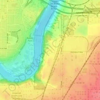
Name: Strathcona Science Provincial Park topographic map, elevation, terrain.
Average elevation: 653 m
Minimum elevation: 608 m
Maximum elevation: 691 m
Thank you for supporting this site ❤️
Make a donation
Make a donation