
Make a donation
Panguitch topographic map
Click on the map to display elevation.
Make a donation
Panguitch
Panguitch has a cool semi-arid climate (Köppen BSk) with summers featuring hot afternoons and cold mornings, and cold, dry winters. The high altitude and relatively high latitude means that mornings are cold throughout the year and freezing for most of it: between 1971 and 2000 an average of 227.7 mornings fell below freezing and 16.5 mornings fell to or below 0 °F (−17.8 °C). Maxima, however, can be expected to top freezing on all but fourteen afternoons during an average year, and the winters are so dry that snowfall is light, averaging only 19.2 inches or 0.49 metres with median cover never much above 1 inch or 0.025 metres. The most snowfall in a month has been 32.0 inches (0.81 m) in the famously cold January 1949, and the most in a season 48.5 inches (1.23 m) from July 1951 to June 1952. Mild, dry winters like 1976/1977 and 1980/1981 can in contrast see negligible snowfall for an entire season.
Make a donation
About this map
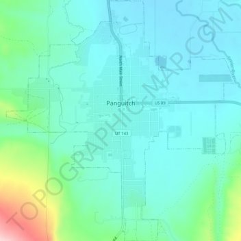
Name: Panguitch topographic map, elevation, terrain.
Location: Panguitch, Garfield County, Utah, United States (37.79979 -112.45990 37.83991 -112.41164)
Average elevation: 2,043 m
Minimum elevation: 1,997 m
Maximum elevation: 2,233 m
Make a donation
Other topographic maps
Click on a map to view its topography, its elevation and its terrain.
Mount Ellen
United States > Utah > Garfield County
Mount Ellen is an ultra prominent peak, meaning that it has more than 1,500 metres (4,921 ft) of topographic prominence, standing out considerably from nearby mountains. It stands in the watershed of the Fremont River, which together with Muddy Creek forms the Dirty Devil River, which drains into the Colorado…
Average elevation: 3,149 m
Make a donation
Make a donation