
Stoke Prior topographic map
Click on the map to display elevation.
About this map
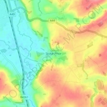
Name: Stoke Prior topographic map, elevation, terrain.
Location: Stoke Prior, Herefordshire, England, HR6 0LG, United Kingdom (52.18566 -2.72047 52.22566 -2.68047)
Average elevation: 103 m
Minimum elevation: 63 m
Maximum elevation: 149 m
Other topographic maps
Click on a map to view its topography, its elevation and its terrain.
Croft Castle
United Kingdom > England > Herefordshire > Yarpole
The present building dates from the 1660s during the time when Herbert Croft was Bishop of Hereford, replacing an earlier house some thirty yards to the west, which was excavated by Herefordshire County Archaeologist Prof. Keith Ray and volunteers in 2002. The manor house is a quadrangular stone structure…
Average elevation: 173 m
Eastnor Deer Park
United Kingdom > England > Herefordshire > Eastnor > Wayend Street
Average elevation: 134 m