Mount Wilson topographic map
Interactive map
Click on the map to display elevation.
About this map
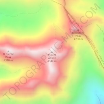
Name: Mount Wilson topographic map, elevation, terrain.
Average elevation: 3,891 m
Minimum elevation: 3,371 m
Maximum elevation: 4,291 m

Click on the map to display elevation.
Name: Mount Wilson topographic map, elevation, terrain.
Average elevation: 3,891 m
Minimum elevation: 3,371 m
Maximum elevation: 4,291 m