
Thank you for supporting this site ❤️
Make a donation
Make a donation
Perry topographic map
Click on the map to display elevation.
Thank you for supporting this site ❤️
Make a donation
Make a donation
About this map
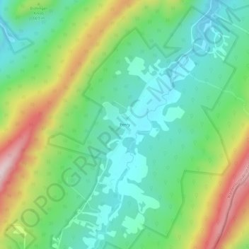
Name: Perry topographic map, elevation, terrain.
Location: Perry, Hardy County, West Virginia, United States (38.95150 -78.69502 38.99150 -78.65502)
Average elevation: 623 m
Minimum elevation: 493 m
Maximum elevation: 887 m
Thank you for supporting this site ❤️
Make a donation
Make a donation
Other topographic maps
Click on a map to view its topography, its elevation and its terrain.