
Thank you for supporting this site ❤️
Make a donation
Make a donation
Ivy topographic map
Click on the map to display elevation.
Thank you for supporting this site ❤️
Make a donation
Make a donation
About this map
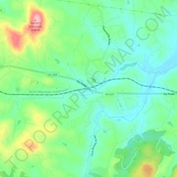
Name: Ivy topographic map, elevation, terrain.
Location: Ivy, Albemarle County, Virginia, 22945, United States (38.03653 -78.61668 38.07653 -78.57668)
Average elevation: 189 m
Minimum elevation: 140 m
Maximum elevation: 298 m
Thank you for supporting this site ❤️
Make a donation
Make a donation
Other topographic maps
Click on a map to view its topography, its elevation and its terrain.
Beaver Creek Park
United States > Virginia > Albemarle County > Charlottesville > Wickham Pond
Average elevation: 185 m
Thank you for supporting this site ❤️
Make a donation
Make a donation
Darden Towe Park
United States > Virginia > Albemarle County > Charlottesville > Franklin
Average elevation: 129 m