
Thank you for supporting this site ❤️
Make a donation
Make a donation
Tivoli Terme topographic map
Click on the map to display elevation.
Thank you for supporting this site ❤️
Make a donation
Make a donation
About this map
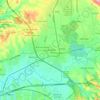
Name: Tivoli Terme topographic map, elevation, terrain.
Location: Tivoli Terme, Tivoli, Roma Capitale, Lazio, 00011, Italy (41.91446 12.67771 41.99446 12.75771)
Average elevation: 66 m
Minimum elevation: 20 m
Maximum elevation: 166 m
Thank you for supporting this site ❤️
Make a donation
Make a donation
Other topographic maps
Click on a map to view its topography, its elevation and its terrain.