
Arroio Brasino topographic map
Interactive map
Click on the map to display elevation.
About this map
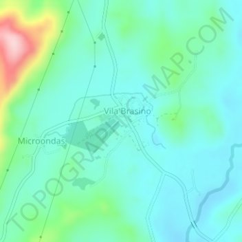
Name: Arroio Brasino topographic map, elevation, terrain.
Average elevation: 99 m
Minimum elevation: 52 m
Maximum elevation: 274 m
Other topographic maps
Click on a map to view its topography, its elevation and its terrain.
Cerro Grande do Sul
Brazil > Rio Grande do Sul > Cerro Grande do Sul
Cerro Grande do Sul, Região Geográfica Imediata de Camaquã, Região Geográfica Intermediária de Porto Alegre, Rio Grande do Sul, South Region, Brazil
Average elevation: 214 m