
Thank you for supporting this site ❤️
Make a donation
Make a donation
Oba River topographic map
Click on the map to display elevation.
Thank you for supporting this site ❤️
Make a donation
Make a donation
About this map
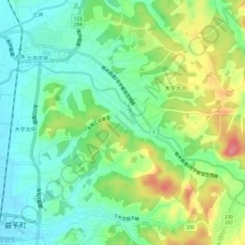
Name: Oba River topographic map, elevation, terrain.
Location: Oba River, Mashiko, Haga County, Tochigi Prefecture, Japan (36.47364 140.09009 36.49002 140.13329)
Average elevation: 106 m
Minimum elevation: 73 m
Maximum elevation: 166 m
Thank you for supporting this site ❤️
Make a donation
Make a donation