Cedar Grove topographic map
Interactive map
Click on the map to display elevation.
About this map
![Cedar Grove topographic map, elevation, terrain](/pub/maps/relation/gf3l/7kn4s/thumbnail.jpg)
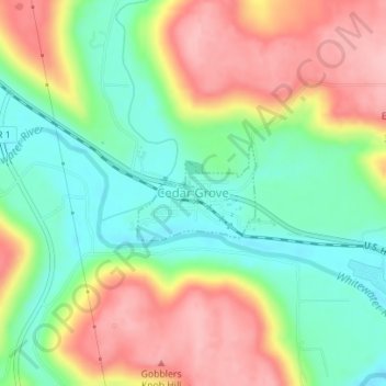
Name: Cedar Grove topographic map, elevation, terrain.
Location: Cedar Grove, Franklin County, Indiana, United States (39.35359 -84.94298 39.36025 -84.93220)
Average elevation: 230 m
Minimum elevation: 166 m
Maximum elevation: 308 m
Other topographic maps
Click on a map to view its topography, its elevation and its terrain.
![Metamora topographic map, elevation, terrain](/pub/maps/node/4x51/9qjtl4s/icon.jpg)
Metamora
United States > Indiana > Franklin County
Metamora, Franklin County, Indiana, 47030, United States
Average elevation: 242 m
![Oldenburg topographic map, elevation, terrain](/pub/maps/relation/hrcz/3sztp/icon.jpg)
Oldenburg
United States > Indiana > Franklin County
Oldenburg, Franklin County, Indiana, United States
Average elevation: 288 m
![Hamburg topographic map, elevation, terrain](/pub/maps/node/bg5k/hfs1rrr/icon.jpg)
Hamburg
United States > Indiana > Franklin County
Hamburg, Franklin County, Indiana, 47036, United States
Average elevation: 274 m
![Peppertown topographic map, elevation, terrain](/pub/maps/node/fj18/hf23hrr/icon.jpg)
Peppertown
United States > Indiana > Franklin County
Peppertown, Franklin County, Indiana, 47030, United States
Average elevation: 282 m
![Andersonville topographic map, elevation, terrain](/pub/maps/node/6918/s9499mt/icon.jpg)
Andersonville
United States > Indiana > Franklin County
Andersonville, Franklin County, Indiana, United States
Average elevation: 317 m
![Laurel topographic map, elevation, terrain](/pub/maps/relation/dhtp/slcnh/icon.jpg)
Laurel
United States > Indiana > Franklin County
Laurel, Franklin County, Indiana, United States
Average elevation: 240 m
![New Trenton topographic map, elevation, terrain](/pub/maps/node/hcrr/39nzhdn/icon.jpg)
New Trenton
United States > Indiana > Franklin County
New Trenton, Franklin County, Indiana, 47035, United States
Average elevation: 230 m
![Bath topographic map, elevation, terrain](/pub/maps/node/869m/dblg8z4/icon.jpg)
Bath
United States > Indiana > Franklin County
Bath, Franklin County, Indiana, 47010, United States
Average elevation: 312 m
![Scipio topographic map, elevation, terrain](/pub/maps/node/9d57/51m7c57/icon.jpg)
Scipio
United States > Indiana > Franklin County
Scipio, Franklin County, Indiana, United States
Average elevation: 273 m
![Mount Carmel topographic map, elevation, terrain](/pub/maps/relation/m1rr/k9t3l/icon.jpg)
Mount Carmel
United States > Indiana > Franklin County
Mount Carmel, Franklin County, Indiana, United States
Average elevation: 307 m
![Blooming Grove topographic map, elevation, terrain](/pub/maps/node/cs5k/k5trwb3/icon.jpg)
Blooming Grove
United States > Indiana > Franklin County
Blooming Grove, Franklin County, Indiana, United States
Average elevation: 299 m
![Lake View topographic map, elevation, terrain](/pub/maps/node/42rr/9q9974s/icon.jpg)
Lake View
United States > Indiana > Franklin County
Lake View, Franklin County, Indiana, United States
Average elevation: 301 m
![Sharptown topographic map, elevation, terrain](/pub/maps/node/whtf/n3wz83q/icon.jpg)
Sharptown
United States > Indiana > Franklin County
Sharptown, Franklin County, Indiana, 47016, United States
Average elevation: 298 m
![Brookville topographic map, elevation, terrain](/pub/maps/relation/64nh/slc1h/icon.jpg)
Brookville
United States > Indiana > Franklin County
Brookville, Franklin County, Indiana, United States
Average elevation: 228 m