
South Lake topographic map
Interactive map
Click on the map to display elevation.
About this map
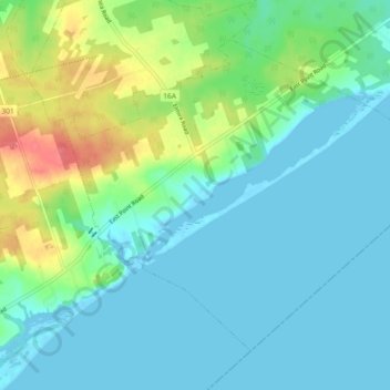
Name: South Lake topographic map, elevation, terrain.
Average elevation: 16 m
Minimum elevation: -3 m
Maximum elevation: 64 m
Other topographic maps
Click on a map to view its topography, its elevation and its terrain.
North Lake
Canada > Prince Edward Island > Rural Municipality of Eastern Kings
North Lake, Rural Municipality of Eastern Kings, Kings County, Prince Edward Island, Canada
Average elevation: 14 m