
Ovia South-West topographic map
Interactive map
Click on the map to display elevation.
About this map
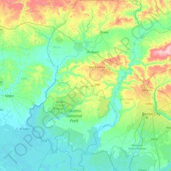
Name: Ovia South-West topographic map, elevation, terrain.
Location: Ovia South-West, Edo, Nigeria (6.05257 5.00919 6.88886 5.49625)
Average elevation: 55 m
Minimum elevation: -1 m
Maximum elevation: 263 m
Other topographic maps
Click on a map to view its topography, its elevation and its terrain.