
Thank you for supporting this site ❤️
Make a donation
Make a donation
Custer Peak topographic map
Click on the map to display elevation.
Thank you for supporting this site ❤️
Make a donation
Make a donation
About this map
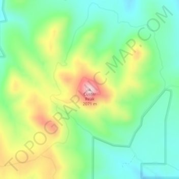
Name: Custer Peak topographic map, elevation, terrain.
Location: Custer Peak, Lawrence County, South Dakota, United States (44.24437 -103.73535 44.24447 -103.73525)
Average elevation: 1,883 m
Minimum elevation: 1,783 m
Maximum elevation: 2,061 m
Thank you for supporting this site ❤️
Make a donation
Make a donation
Other topographic maps
Click on a map to view its topography, its elevation and its terrain.