
Thank you for supporting this site ❤️
Make a donation
Make a donation
Kalterherberg topographic map
Click on the map to display elevation.
Thank you for supporting this site ❤️
Make a donation
Make a donation
About this map
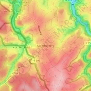
Name: Kalterherberg topographic map, elevation, terrain.
Average elevation: 547 m
Minimum elevation: 455 m
Maximum elevation: 600 m
Thank you for supporting this site ❤️
Make a donation
Make a donation
Other topographic maps
Click on a map to view its topography, its elevation and its terrain.
Troisdorfer Weiher
Deutschland > Nordrhein-Westfalen > Städteregion Aachen > Monschau > Konzen
Average elevation: 546 m
Kalltal
Deutschland > Nordrhein-Westfalen > Städteregion Aachen > Monschau > Entenpfuhl
Average elevation: 552 m