

Thank you for supporting this site ❤️
Make a donation
Make a donation
Hoheging topographic map
Click on the map to display elevation.
Thank you for supporting this site ❤️
Make a donation
Make a donation
Hoheging
Die Bauerschaft Hoheging gehört zum Dreiländereck "HoKeBü", das aus den Gemeinden Hoheging, Kellerhöhe (gehört zur Stadt Cloppenburg) und Bürgermoor (gehört zur Gemeinde Garrel) besteht.
Thank you for supporting this site ❤️
Make a donation
Make a donation
About this map
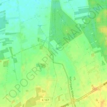
Name: Hoheging topographic map, elevation, terrain.
Average elevation: 39 m
Minimum elevation: 28 m
Maximum elevation: 53 m
Thank you for supporting this site ❤️
Make a donation
Make a donation