
Thank you for supporting this site ❤️
Make a donation
Make a donation
Zoyatepec topographic map
Click on the map to display elevation.
Thank you for supporting this site ❤️
Make a donation
Make a donation
About this map
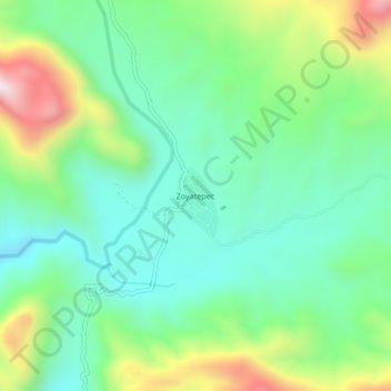
Name: Zoyatepec topographic map, elevation, terrain.
Location: Zoyatepec, Chilpancingo de los Bravo, Guerrero, México (17.31000 -99.57500 17.35000 -99.53500)
Average elevation: 864 m
Minimum elevation: 645 m
Maximum elevation: 1,350 m
Thank you for supporting this site ❤️
Make a donation
Make a donation
Other topographic maps
Click on a map to view its topography, its elevation and its terrain.
Deportivo "Los Galeana"
México > Guerrero > Chilpancingo de los Bravo > Chilpancingo de los Bravo
Average elevation: 1,339 m
Parque de San Mateo
México > Guerrero > Chilpancingo de los Bravo > Chilpancingo de los Bravo
Average elevation: 1,317 m