
Novo Mesto topographic map
Interactive map
Click on the map to display elevation.
About this map
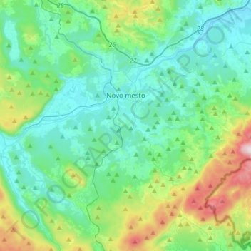
Name: Novo Mesto topographic map, elevation, terrain.
Location: Novo Mesto, Slovenia (45.68452 15.09285 45.87689 15.31642)
Average elevation: 344 m
Minimum elevation: 149 m
Maximum elevation: 1,083 m
Other topographic maps
Click on a map to view its topography, its elevation and its terrain.