
Thank you for supporting this site ❤️
Make a donation
Make a donation
Rangeley Plantation topographic map
Click on the map to display elevation.
Thank you for supporting this site ❤️
Make a donation
Make a donation
About this map
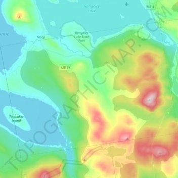
Name: Rangeley Plantation topographic map, elevation, terrain.
Location: Rangeley Plantation, Franklin County, Maine, United States (44.83975 -70.79529 44.93991 -70.60877)
Average elevation: 577 m
Minimum elevation: 439 m
Maximum elevation: 956 m
Thank you for supporting this site ❤️
Make a donation
Make a donation
Other topographic maps
Click on a map to view its topography, its elevation and its terrain.