
Khon Kaen Province topographic map
Interactive map
Click on the map to display elevation.
About this map
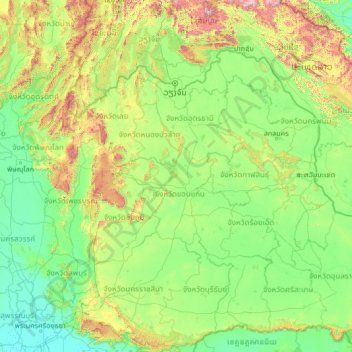
Name: Khon Kaen Province topographic map, elevation, terrain.
Location: Khon Kaen Province, Thailand (14.04224 100.07529 19.16224 105.19529)
Average elevation: 288 m
Minimum elevation: 2 m
Maximum elevation: 2,597 m