
Thank you for supporting this site ❤️
Make a donation
Make a donation
Cabanne Place topographic map
Click on the map to display elevation.
Thank you for supporting this site ❤️
Make a donation
Make a donation
About this map
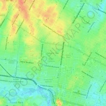
Name: Cabanne Place topographic map, elevation, terrain.
Location: Cabanne Place, St. Louis, Missouri, 63113, United States (38.63700 -90.28706 38.67700 -90.24706)
Average elevation: 159 m
Minimum elevation: 140 m
Maximum elevation: 182 m
Thank you for supporting this site ❤️
Make a donation
Make a donation
Other topographic maps
Click on a map to view its topography, its elevation and its terrain.