
Shira topographic map
Interactive map
Click on the map to display elevation.
Shira
Mount Kilimanjaro or just Kilimanjaro (/ˌkɪlɪmənˈdʒɑːroʊ/), with its three volcanic cones, Kibo, Mawenzi, and Shira, is a dormant volcano in Tanzania. It is the highest mountain in Africa and the highest single free-standing mountain in the world, with its summit of 5,895 metres (19,341 ft) above sea level and at about 4,900 metres (16,100 ft) high from its plateau base. Kilimanjaro is also the fourth most topographically prominent peak on Earth. The first people known to have reached the summit of the mountain were Hans Meyer and Ludwig Purtscheller, in 1889. The mountain is part of Kilimanjaro National Park and is a major climbing destination. Because of its shrinking glaciers and disappearing ice fields, the mountain has been the subject of many scientific studies.
About this map
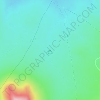
Name: Shira topographic map, elevation, terrain.
Location: Shira, Hai, Kilimanjaro, Northern Zone, Tanzania (-3.03377 37.23712 -3.03367 37.23722)
Average elevation: 3,614 m
Minimum elevation: 3,551 m
Maximum elevation: 3,818 m
Other topographic maps
Click on a map to view its topography, its elevation and its terrain.