
Thank you for supporting this site ❤️
Make a donation
Make a donation
Bonnechere Provincial Park topographic map
Click on the map to display elevation.
Thank you for supporting this site ❤️
Make a donation
Make a donation
About this map
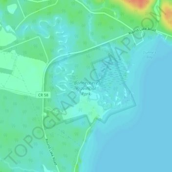
Name: Bonnechere Provincial Park topographic map, elevation, terrain.
Average elevation: 174 m
Minimum elevation: 166 m
Maximum elevation: 209 m
Thank you for supporting this site ❤️
Make a donation
Make a donation
Other topographic maps
Click on a map to view its topography, its elevation and its terrain.
Bonnechere
Canada > Ontario > Renfrew County > Killaloe, Hagarty and Richards
Average elevation: 174 m
Madawaska Highlands
Canada > Ontario > Renfrew County > Killaloe, Hagarty and Richards
Average elevation: 272 m
Thank you for supporting this site ❤️
Make a donation
Make a donation