
汤山矿坑公园 topographic map
Interactive map
Click on the map to display elevation.
About this map
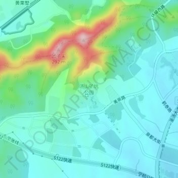
Name: 汤山矿坑公园 topographic map, elevation, terrain.
Location: 汤山矿坑公园, 11号, 汤山街道, 江宁区, 南京市, 江苏省, 中国 (32.03974 119.02897 32.04777 119.03650)
Average elevation: 87 m
Minimum elevation: 35 m
Maximum elevation: 267 m
Other topographic maps
Click on a map to view its topography, its elevation and its terrain.