
Thank you for supporting this site ❤️
Make a donation
Make a donation
Hebertshausen topographic map
Click on the map to display elevation.
Thank you for supporting this site ❤️
Make a donation
Make a donation
About this map
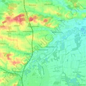
Name: Hebertshausen topographic map, elevation, terrain.
Location: Hebertshausen, Landkreis Dachau, Bayern, 85241, Deutschland (48.26239 11.41988 48.32846 11.53162)
Average elevation: 485 m
Minimum elevation: 459 m
Maximum elevation: 538 m
Thank you for supporting this site ❤️
Make a donation
Make a donation
Other topographic maps
Click on a map to view its topography, its elevation and its terrain.